
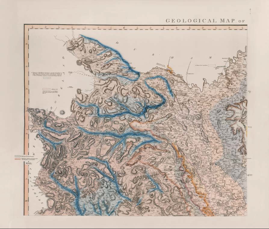
GEOLOGICAL MAP OF YORKSHIRE, by W.SMITH, Mineral Surveyor
First published as Part IV of A New Geological Atlas of England and Wales…1821 in four sheets. SE sheet dated 1821. According to Phillips (1844, p96), this map was published in the summer of 1821
Copies known dated 1824, 1831
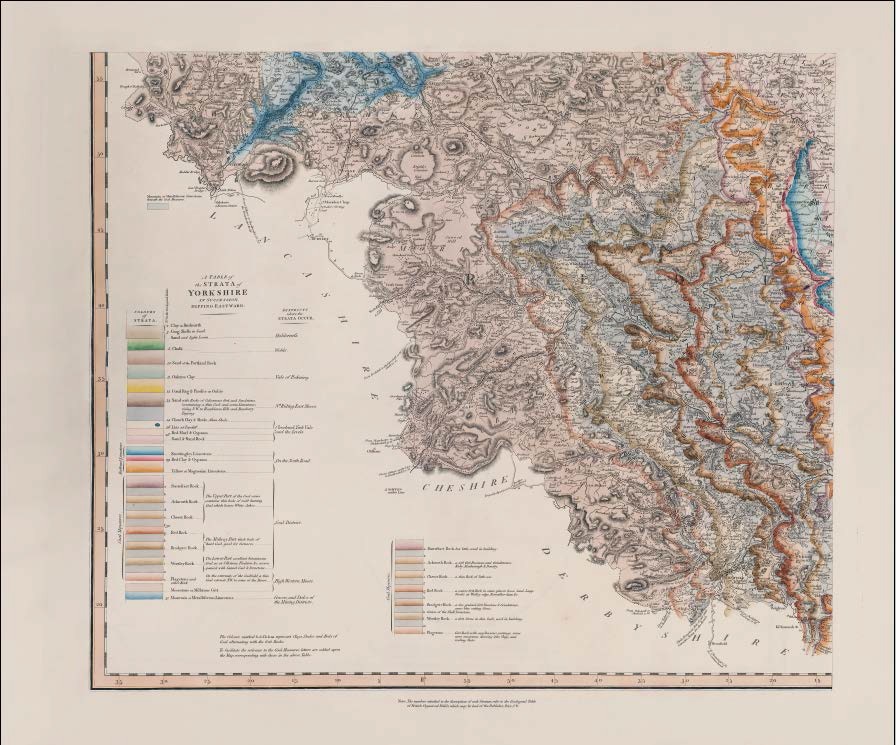
Unlike any other county map of Smith’s, the Yorkshire map was in four sheets, and in addition to the usual coloured boxes and text around the county margins identifying the strata, the southeast sheet contains a coloured stratigraphical key, A TABLE of the STRATA of YORKSHIRE IN SUCCESSION DIPPING EASTWARD. This key shows Smith’s typical denser colouring at the base of each unit and shows the numbers of the strata in the Geological Table of British Organized Fossils. The Coal Measures (Smith’s No 30) are subdivided into thirteen units, a to n.
Stratigraphy
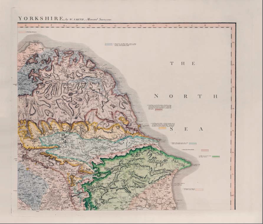
- 2 4 Brickearth Sand & Clay, in Cliffs which are washed away by the Sea. / Brickearth and Sand, in low Cliffs over the Chalk
- 3 The Crag Shells, and Sand occur in little Sand Hills in the Interior of Holderness.
- 5 Chalk, dug in great Quantity at Hessle / Chalk excavated for Lime into large Caverns
- 10 Sand of the Portland Rock
- 11 Oaktree Clay, in its course have been many unsuccessful Trials for Coal.
- 12 Coral Rag Oolite or Pisolite / Coral Rag and its Oolite (or Pisolite) the upper part of Scarborough Castle Rock, containing the Corals which are found in its range through Wilts __ Figured and described in Strata identified by Organized Fossils
- 13 Sand, beneath / Sand Rock and Grit Freestone, of the Moors, lying over the Alum Shale, and in Scarborough Castle Hill under the Oolite or Calcareous Freestone __ A thin Coal in the Cliffs, is worked on the Moors, at Danby and other places.
- 14 Clunch Clay and Alum Shale, which is worked for Alum, by Guisbrough and Stokesley to the N.W. extremity of the Hambleton Hills.
- 28 Red Marl with Gypsum
- 28 (Beneath Red Marl) A brown-red Sand and Sand rock containing / Brown-red Sand Rock
- 29 Redland Limestone over the Coal Measures A hard blueish white thin bedded Stone, which at Womersley, Knottingley, and Brotherton, makes the Lime, celebrated for Agricultural purposes.
Red and Blue Clay, and Gypsum
A soft yellowish calcareous freestone or Magnesian Limestone - 30m Shale, thin Coal and Ironstone.
- 15 Flagstones, Penhill and Summersides with other Rock, a Coal beneath.
Millstone Grit A thin bed of Coal over the Millstone Grit, worked at Tanhill, Leyburn, Wilton Fell, &c. - 31 Mountain or Metalliferous Limestone, beneath the Coal Measures alternating with gritstone and Shale called Plate, the breaks in which contain the rich Veins of Lead and Calamine, extensively worked in the Mining Districts of Swaledale, Wensley Dale &c. / Mountain or Metalliferous Limestone, beneath the Coal Measures
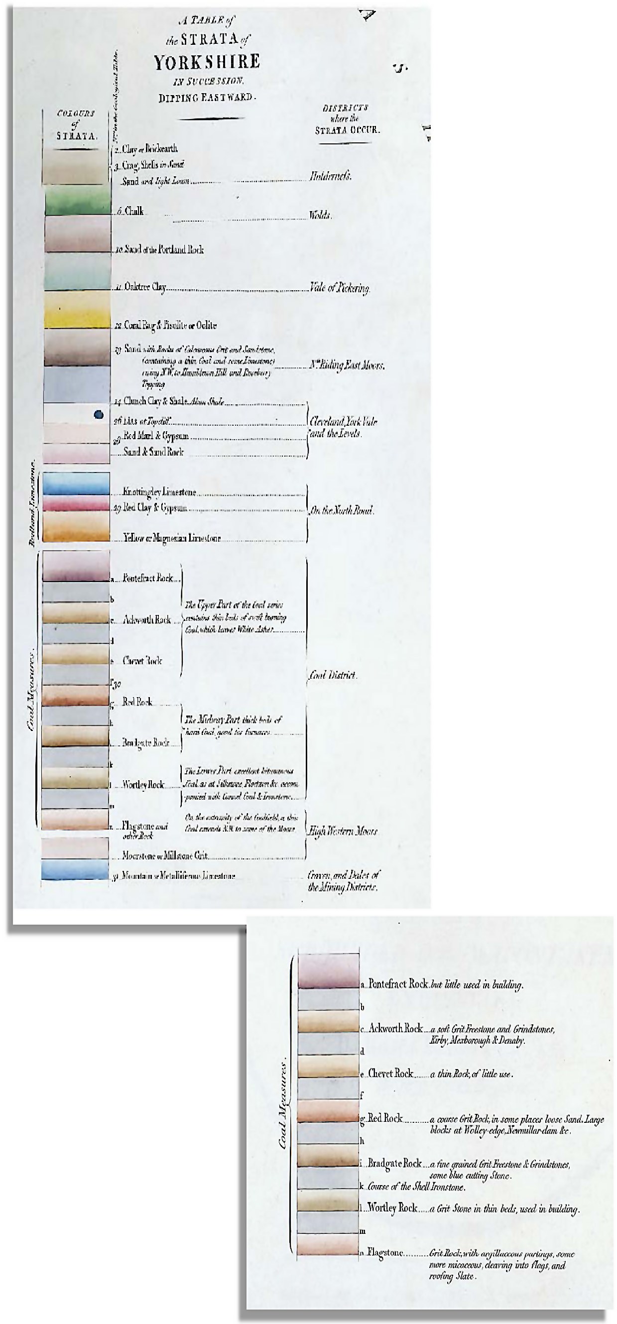
A TABLE of the STRATA of YORKSHIRE IN SUCCESSION
DIPPING EASTWARD.
- 2 Clay or Brickearth
- 3 Crag, Shells in Sand
- 5 Chalk
- 10 Sand of the Portland Rock
- 11 Oaktree Clay
- 12 Coral Rag & Pisolite or Oolite
- 13 Sand with Rocks of Calcareous Grit and Sandstone, (containing a thin Coal and some Limestone) rising N.W. to Hambleton Hill and Roseberry Topping
- 14 Clunch Clay & Shale. Alum Shale
- 26 Lias at Topcliff
- 28 Red Marl & Gypsum
Sand & Sand Rock
Knottingley Limestone - 29 Red Clay & Gypsum
Yellow or Magnesian Limestone - 30a Pontefract Rock but little used in building
- 30b
- 30c Ackworth Rock a soft Grit Freestone and Grindstones, Kirby, Mexborough & Denaby.
- 30d
- 30e Chevet Rock a thin Rock, of little use.
- 30f
- 30g Red Rock a coarse Grit Rock, in some places loose Sand. Large blocks at Wolley-edge, Newmillar-dam &c.
- 30h
- 30i Bradgate Rock a fine grained Grit Freestone & Grindstones, some blue cutting Stone.
- 30k Course of the Shell Ironstone
- 30l Wortley Rock a Grit Stone in thin beds, used in building.
- 30m
- 30n Flagstone and other Rock Grit Rock, with argillaceous partings, some more micaceous, cleaving into flags, and roofing slate.
Moorstone or Millstone Grit - 31 Mountain or Metalliferous Limestone
The colours marked b.d.f.h.k.m. represent Clays, Shales and Beds of Coal, alternating with the Grit Rocks.
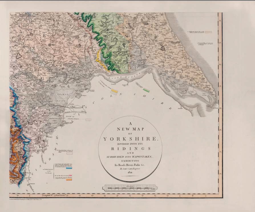
Description of the atlas counties from: A Memoir to the Map and Delineation of the Strata of England and Wales with part of Scotland
by William Smith (1815)
