
General Roy’s 1784 Baseline for the Principal Triangulation measured on Hounslow Heath (27,404 feet)
The 1st Principal Triangulation of the United Kingdom and Ireland was conducted over six decades and was a remarkable achievement which significantly improved the accuracy of 19th century maps of the country. The Principal Triangulation commenced in 1783 under the direction of General William Roy with the objective of connecting the observatories of Greenwich and Paris and determining the difference in longitude between them. After Roy’s death in 1790, the survey was extended across the UK and Ireland under the direction of Colonel Williams, General Mudge, General Colby, Colonel Hall and finally Colonel Henry James. Apart from improving map accuracy, the triangulation allowed Alexander Clarke to compute a spheroid for the earth and make density calculations,
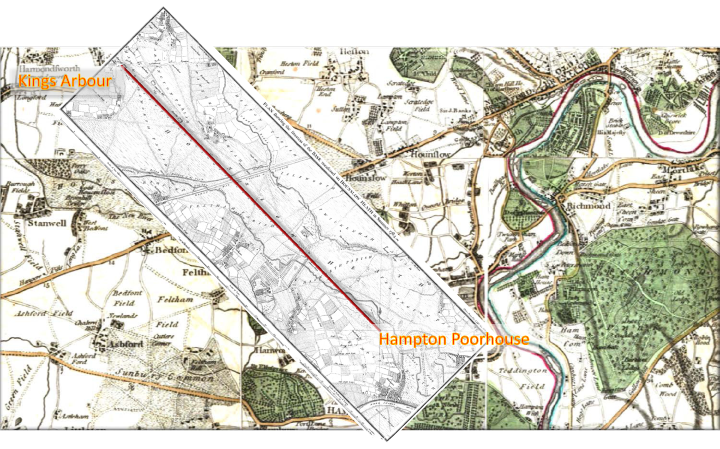
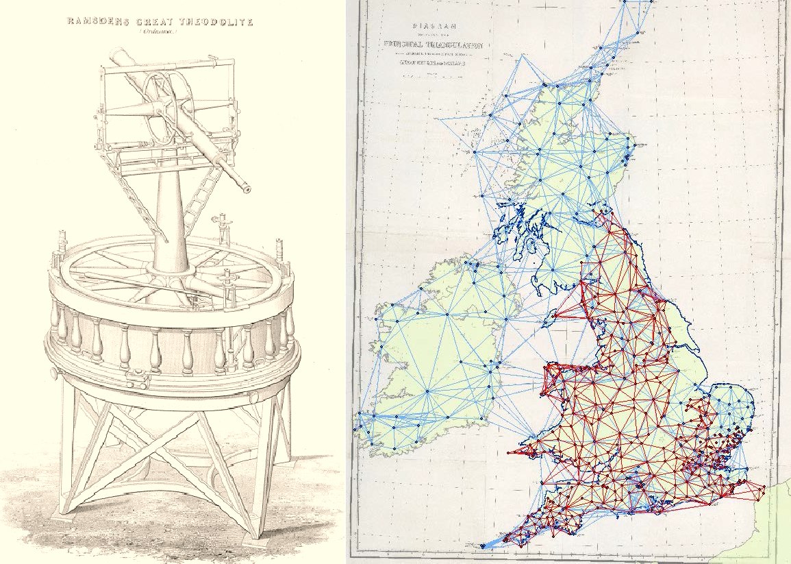
The first stage in the triangulation was the measurement of an accurate base-line between Kings Arbour (site of Heathrow Airport) and the Poor House at Hampton. This was achieved firstly by iron bars and deal rods and re-measured using glass tubes. Corrections were made for temperature and humidity and the line accurately levelled; the final accuracy is estimated at 1 inch in 27,400 ft. After completion of the line a number of triangulations were made in a south-easterly direction towards the Kent coast. The triangulations were made using a specially commissioned theodolite constructed by Jesse Ramsden. The Great Theodolite has a base circle of three feet and was accurate to one second of arc. An illustration of the Ramsden Theodolite is given below as is a map of the Principal Triangulations (red are pre-1810, blue post-1810). As the triangulation proceeded it become obvious that there were large inaccuracies in existing maps of the country. In 1799 Mudge and Dalby made a number of severe criticisms of the “erroneous state of our maps” (see Isaac Taylor’s Dorset map below).
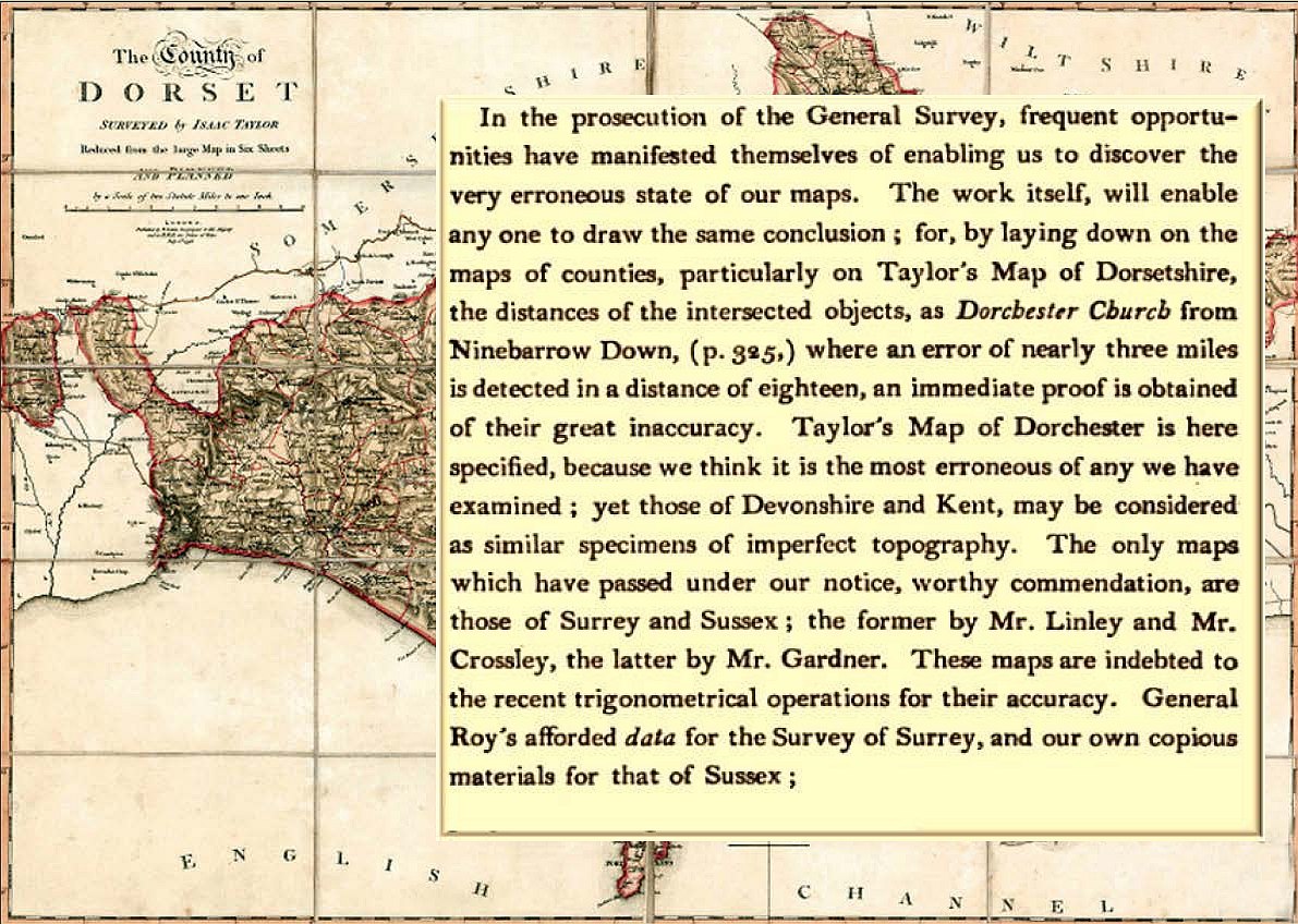
Isaac Taylor’s Map of Dorset with comments by Mudge and Dalby (1799)
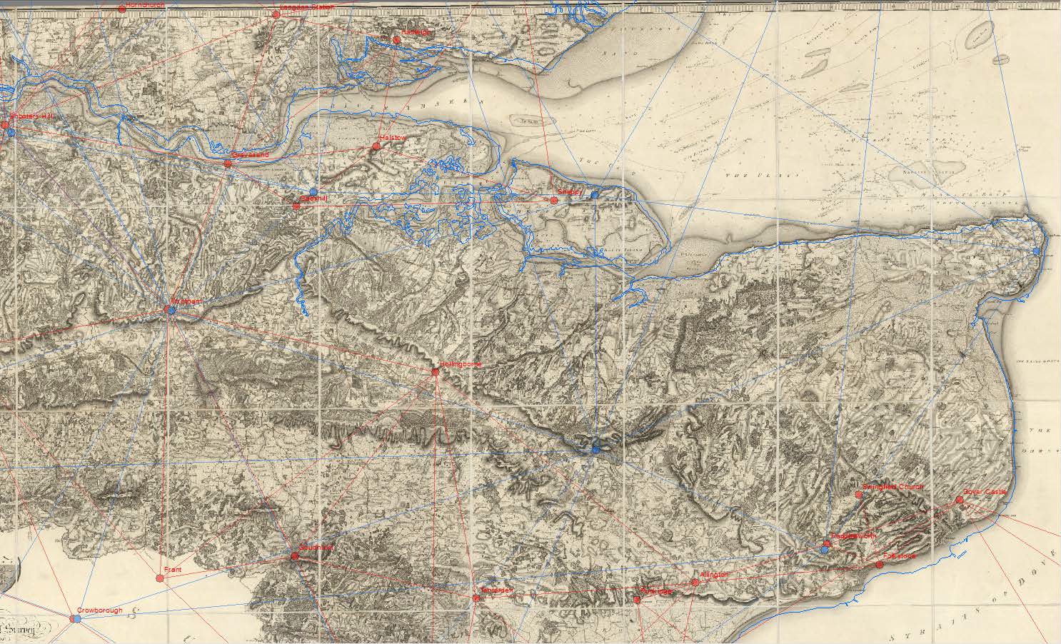
The 1st Principal Triangulation of the United Kingdom and Ireland effectively led to the birth of the Ordnance Survey and the first map made was Mudge and Faden’s 1801 map of Kent. The map is reproduced below and has been overlain by the Principal Triangulations. As previously mentioned, Mudge and Dalby were critical of current maps specifying in particular those of Dorset, Kent and Devonshire. For comparison the Smith County Geological map of Kent, which uses Cary’s 1819 New Map of Kent as a base is shown beneath the Mudge and Faden map. The modern coastline is shown on both maps. Both maps show a good fit to the coastline and on closer examination of the maps there are some similarities between various topographic features. This would suggest that Cary “had sight” of the 1801 map at the time he produced his 1819 version.
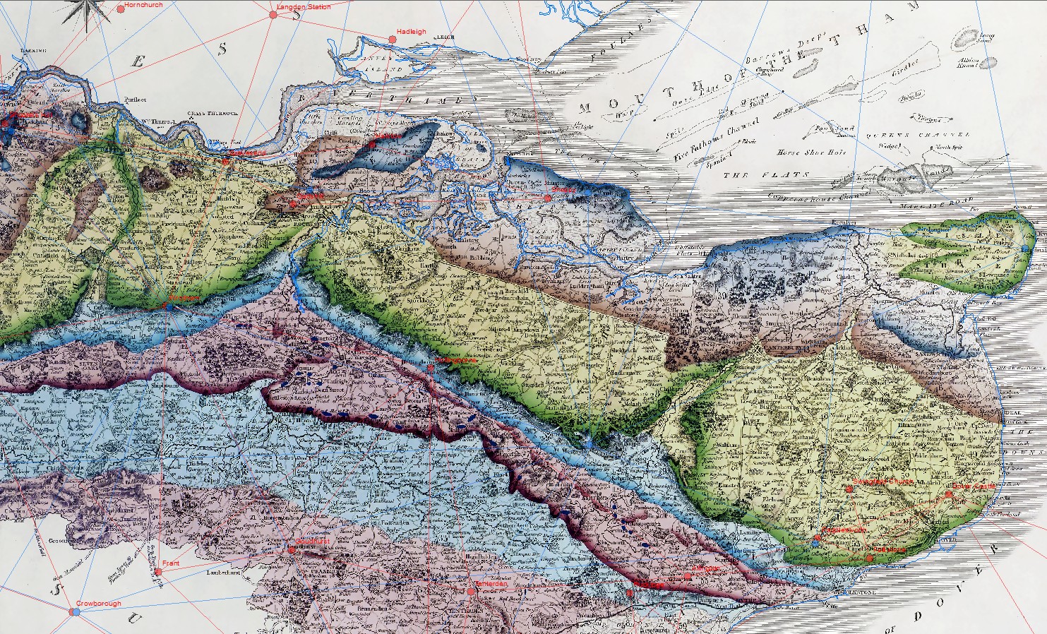
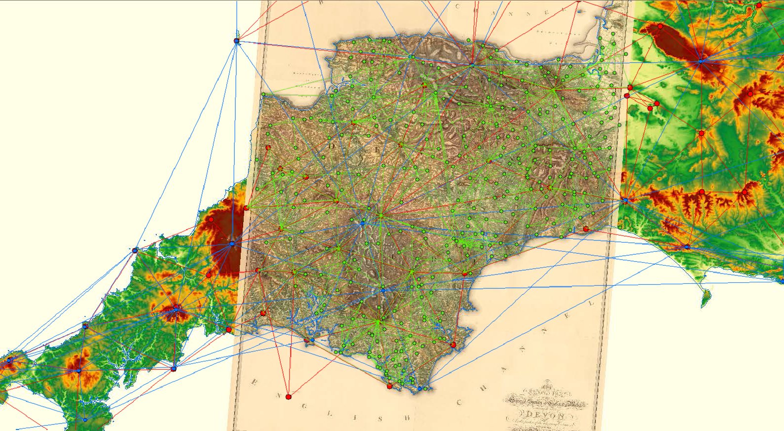
The example below shows the location of the Principal Triangulations made across SW England. The red lines and dots indicate triangulations made pre-1810, blue post-1810 and green secondary triangulations made for Mudge’s 1809 Devon map. Detail from this map (South Hams district) shown below gives a good fit to the modern coastline. This contrasts with the poor fit for the corresponding area of Smith’s 1815 geological map and indicates Cary did not have access to the Principal Triangulation in this area and, although not shown here, the fit of Cary’s 1817 New Map of Devonshire shows a similar level of inaccuracy.
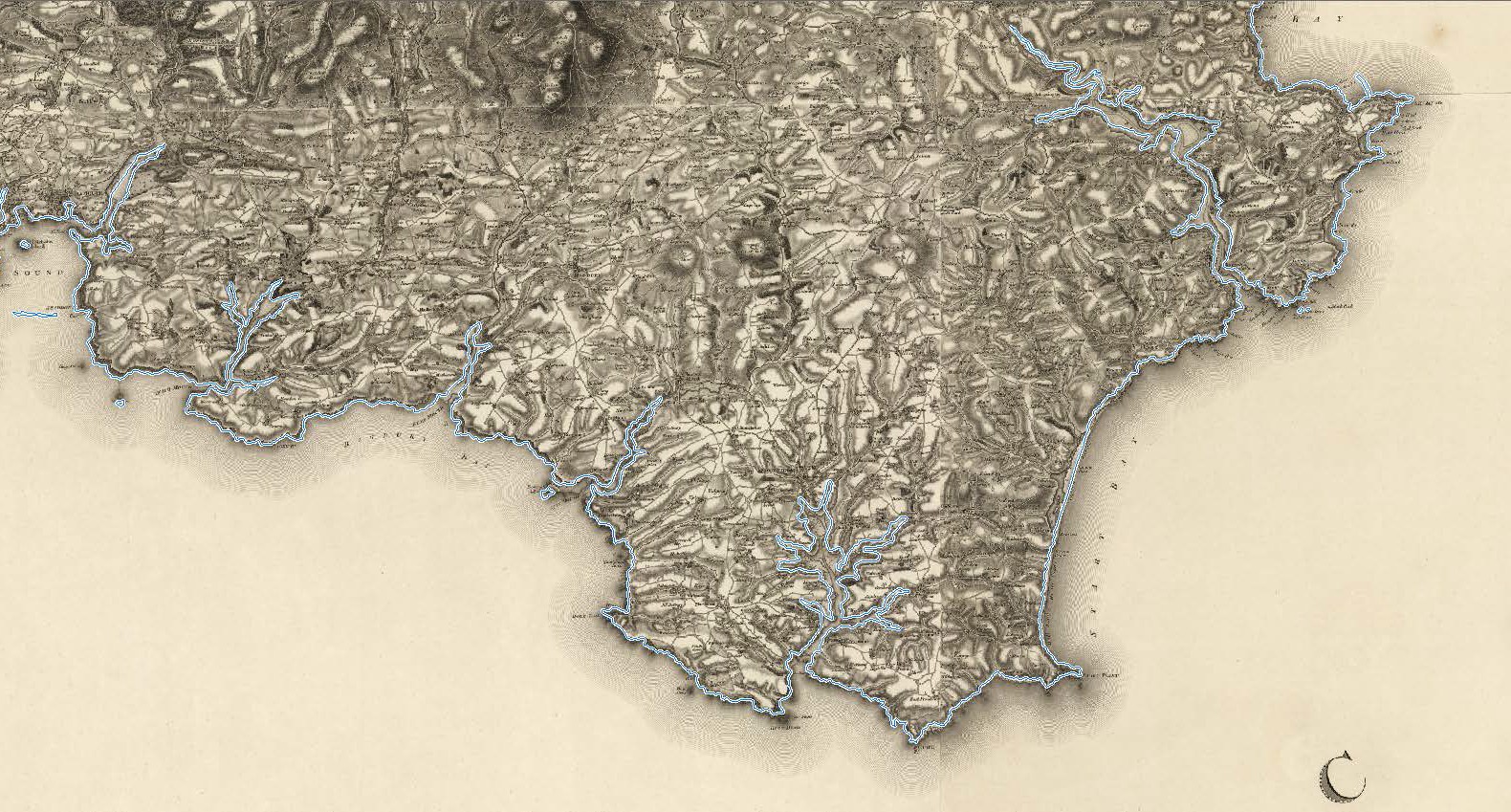
Detail from W. Mudge County of Devon (1809) with modern coastline
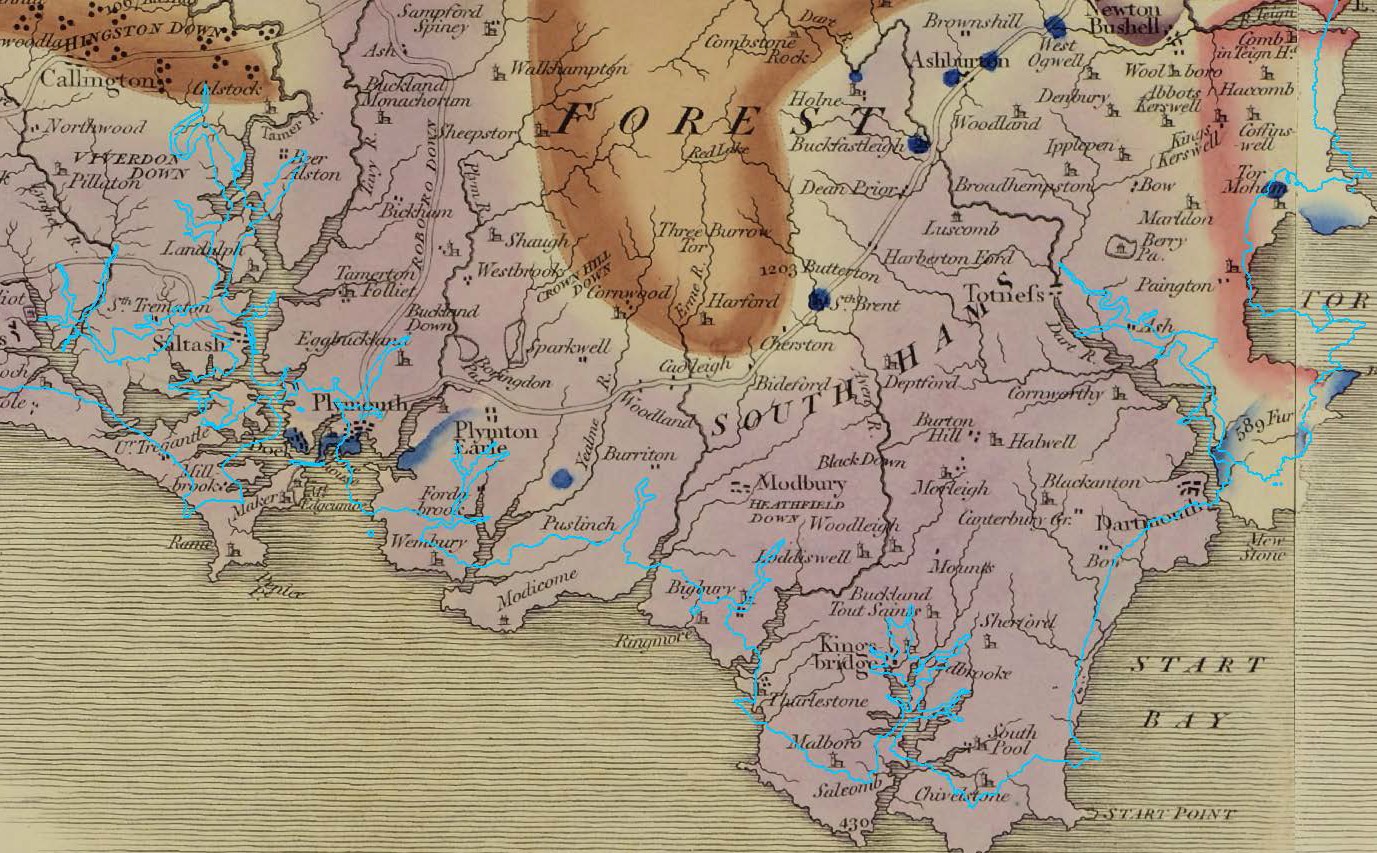
Detail William Smith (1815) A Map with modern coastline
