
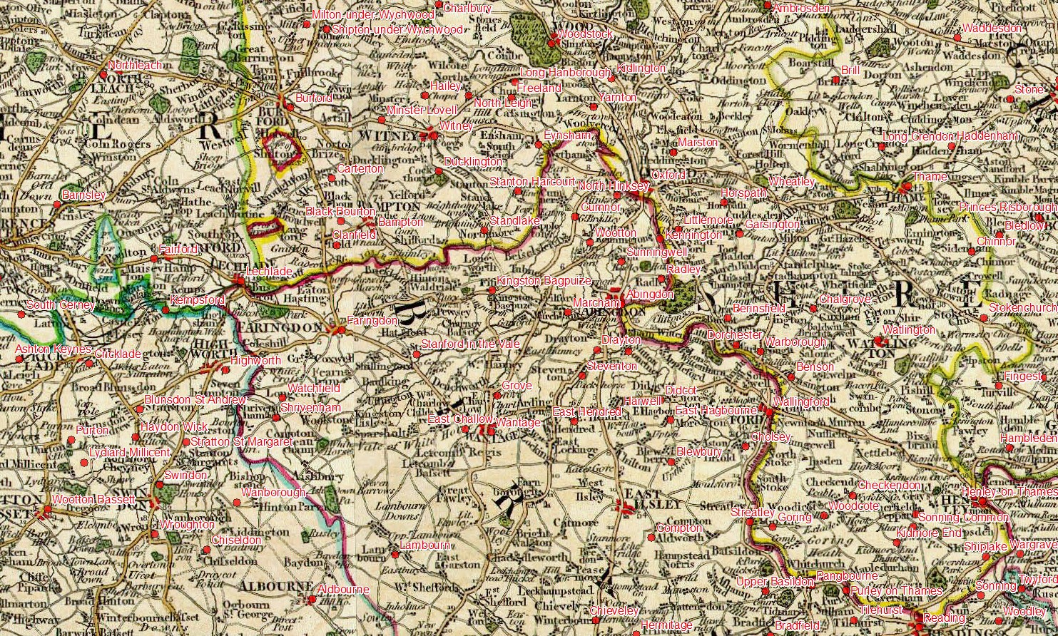
Cary’s New Map of England and Wales and Part of Scotland (1794) overlain by modern towns and villages, this map was the basis for the William Smith 1815 base-map made by John Cary. Georeferencing used Affine Transformation to a Cassini projection (RMS error 860m)
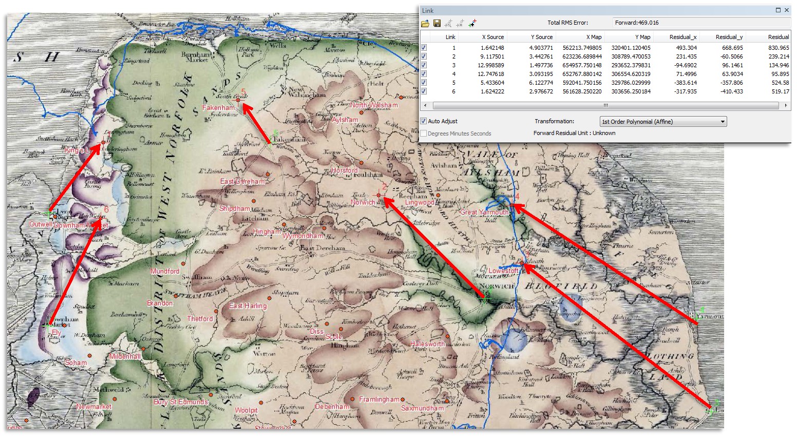
Part of Norfolk from Smith’s 1815 map showing the georeferencing process. Towns and villages from the Smith map (+) are adjusted to the (+) locations of modern towns and villages (labeled in red). The transformation is 1st Order Polynomial (Affine) to a Cassini projection using a Plessis sphere to represent the Earth. Affine transformation was used for all Smith 1815 and County maps with the exception of the Smith 1815 “P”map where the mainland was transformed using a spline transformation which is an interpolation method that estimates values using a mathematical function that minimizes overall surface curvature, resulting in a smooth surface that passes exactly through the input points.
