
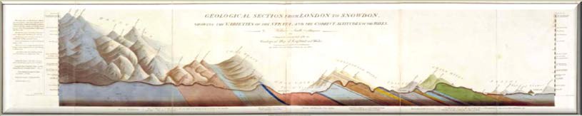
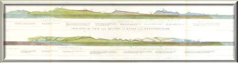
In addition to showing the strata in cross-section, these illustrations display a three-dimensional view of the topography along the line of section. The first, a Geological section from London to Snowdon, showing the varieties of the strata, and the correct altitude of the hills by William Smith Civil Engineer 1817, (Eyles 1969, No. 18), is dated 15th July 1817. It is, effectively, an expansion of the section along the same line shown on the 1815 map. The section is within an engraved border 52” long x 11¾” wide (132 x 29 cm). The other sections are dated 1st May 1819 and comprise five sheets, three of which contain two sections, and two contain one section. All are within an engraved border 10.6” x 35.4” (27 x 90 cm). The sections are:Vertical Section of Strata in Surry [sic] dipping northward Section of Strata in Sussex dipping southwardGeological View and Section in Essex and Hertfordshire Geological View and Section of the country between London and Cambridge
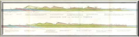
Geological View and Section of Norfolk Geological View and Section through Suffolk to Ely.
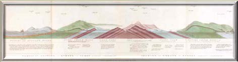
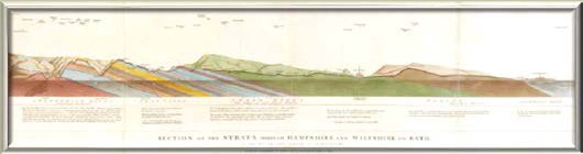
Section of the Strata through Hampshire and Wiltshire to Bath, on the road from Bath to Salisbury.
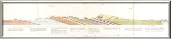
Geological View and Section through Dorsetshire and Somersetshire to Taunton on the road through Yeovil to Wimborn Minster &c .
All sections reproduced here are from a quarto volume in the collections of The Geological Society (LDGSL 746), Geological cross sections through different parts of England & Wales with a geological table, where they are bound with the London to Snowdon section, two Cornish mining sections by Richard Thomas and Smith’s Geological Table of British Organized Fossils. Such complete sets of the sections are rare, as are all of Smith’s geological productions.
