
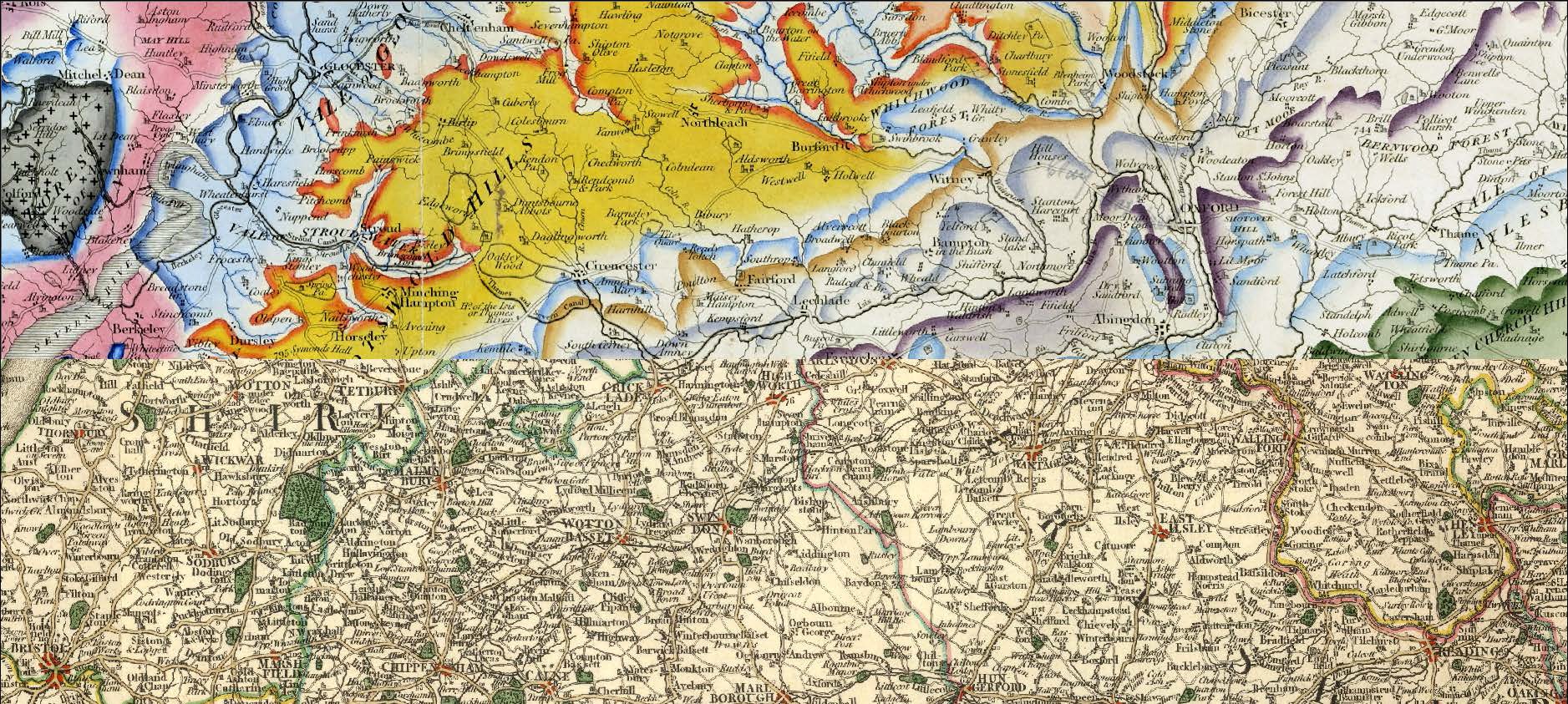
 Cary’s New Map of England & Wales, with part of Scotland (81 plates) was the basis for the Smith 1815 base-map. The example above shows Cary’s map with an overlay of Smith’s map. The similarities are evident but the overlay also illustrates the way that Cary elegantly simplified the base-map in order to reduce villages and roads, at the same time emphasizing rivers and topographic features (hills and vales). Significantly he also includes the boundaries of the landed gentry’s estates
William Smith's Maps – Interactive
© UKOGL 2026
