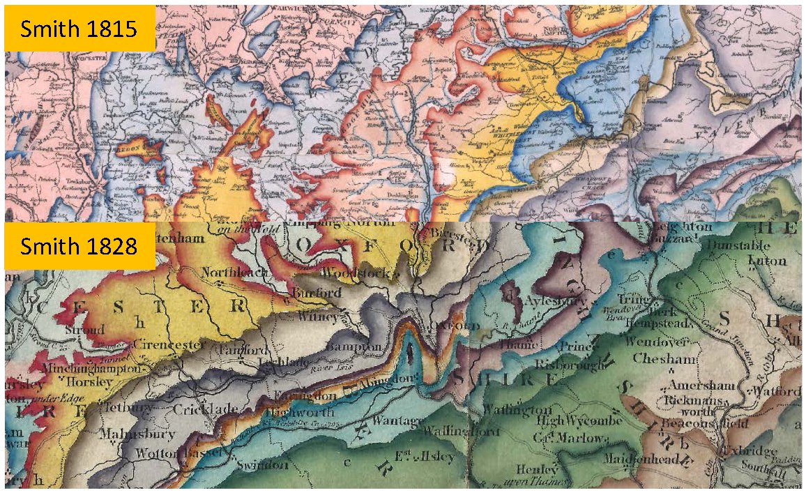
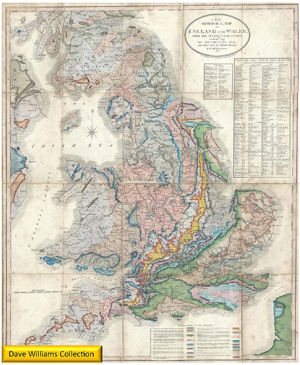
 Dave Williams has generously provided a copy of William Smith’s 1828 map entitled A New Geological Map of England and Wales, with the Inland Navigations; exhibiting the Districts of Coal and other Sites of Mineral Tonnage by W. Smith, Engineer, 1828. This is a late edition; the first edition of the New Map was 1820, other copies are dated 1824 and 1827. There is no change in the geological lines between maps of varying age although the colour shade shows some variation. The maps are hand coloured. The scale is 15 miles to 1 inch and the physical size 63 by 86 cm. This map has been dissected and mounted on linen and folded with a plain marbled cover. The map is shown to the left, with the detail above shown in comparison to the 1815 map. The map is not a reduction of the 1815 map, it was redrawn on a new base from Cary’s 1796 map. The map shows the Coral Rag and the geology of the Isle of Wight is similar to that shown on late versions of the 1815 map. In addition to colours, the geology is differentiated by letters which relate to the legend. This map also shows some geology on the coast of Ireland and France.
DATA SOURCES (William Smith 1828 map)
 Dave Williams has generously provided a copy of William Smith’s 1828 map entitled A New Geological Map of England and Wales, with the Inland Navigations; exhibiting the Districts of Coal and other Sites of Mineral Tonnage by W. Smith, Engineer, 1828. This is a late edition; the first edition of the New Map was 1820, other copies are dated 1824 and 1827. There is no change in the geological lines between maps of varying age although the colour shade shows some variation. The maps are hand coloured. The scale is 15 miles to 1 inch and the physical size 63 by 86 cm. This map has been dissected and mounted on linen and folded with a plain marbled cover. The map is shown to the left, with the detail above shown in comparison to the 1815 map. The map is not a reduction of the 1815 map, it was redrawn on a new base from Cary’s 1796 map. The map shows the Coral Rag and the geology of the Isle of Wight is similar to that shown on late versions of the 1815 map. In addition to colours, the geology is differentiated by letters which relate to the legend. This map also shows some geology on the coast of Ireland and France.

