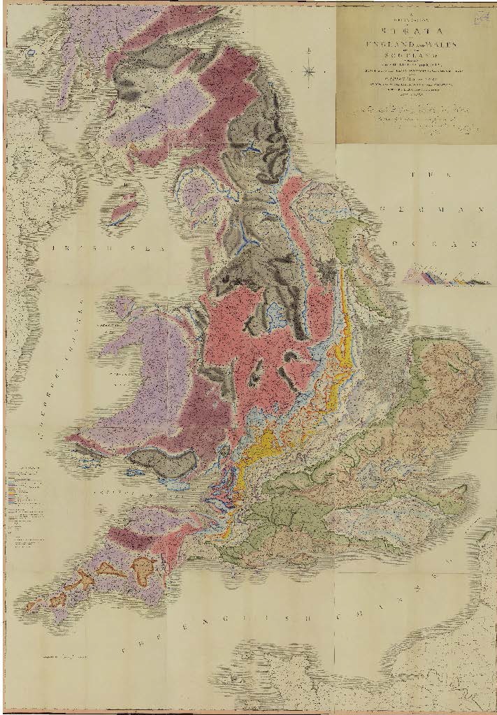
Map A
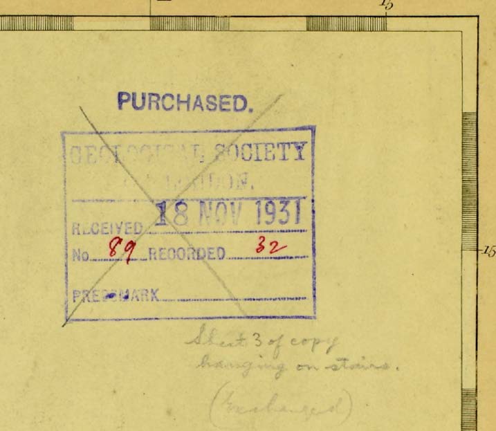
Map A Geological Society
Map A is a fine example of the earliest issue of Smith’s map. It has no number and is not signed and may be one of perhaps 20 maps issued prior to November 1815, probably in late September or in October of that year.
It is probably the Geological Society’s subscription copy as the Society is listed as a subscriber in the Memoir accompanying the map. On 2 May 1815, the Geological Society’s Council appointed a committee comprising the President (William Blake), Arthur Aiken, Henry Warburton, George Bellas Greenough and William Hyde Wollaston to draw up a list of books and maps for purchase by the Society. In their report, received a month later, Council agreed to the purchase of a number of items, including “Smith’s Geological Map of England”.
The Society appears to have purchased a second copy, mounted on canvas, in late 1816. There were five copies of the map in the Society’s collection by 1917 when they were catalogued by Tom Sheppard. Map A, designated as such by Joan and Victor Eyles when they examined it for their 1938 survey of Smith’s maps, was, at some point afterwards, misplaced until its recent rediscovery in the archives of the Geological Society in 2014. Plate III (Title) is not original to the map; it is an exchange for Plate III (Z map) which is torn in the bottom right corner. Map Z now hangs in the foyer at the Geological Society (see Z map exchange below).
Acknowledgements: Caroline Lam, Geological Society; Julian Wilson